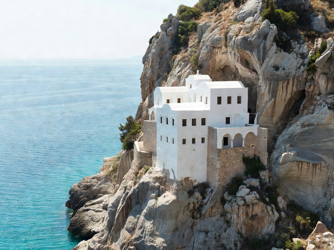
The Dramatic Topography of Amorgos
While islands in the central Cycladic core suffer under heavy seasonal passenger turnover, Amorgos retains an austere, contemplative isolation. Defined by a rugged spine of jagged mountains rising abruptly out of the sea to nearly 800 meters at Mount Krikelos, the island features narrow ridge walks, exposed headlands, and deep marine shelves renowned for underwater clarity.
The architectural jewel of the island is the Monastery of Panagia Hozoviotissa, founded in the eleventh century by Byzantine Emperor Alexios I Komnenos. Clinging to a vertical limestone cliff face 300 meters above the Aegean Sea, the eight-story monastery is barely five meters wide at its narrowest point. Whitewashed stone walls emerge seamlessly from the raw rock face, accessible only by a flight of stone stairs cut into the cliffside.
The Small Cyclades Micro-Archipelago
Strung between Naxos and Amorgos lie the Small Cyclades (Mikres Kyklades): Donousa, Schinoussa, Iraklia, and Koufonisia. Historically bypassed by large commercial container ports and long runways, these smaller landmasses maintain population counts often under two hundred permanent residents.
On Iraklia, footpaths lead to the Cave of Saint John, a sprawling subterranean limestone cavern filled with stalagmites, while Schinoussa offers rolling agricultural lowlands producing prized sweet fava beans (Lathyrus clymenum). Donousa, sitting isolated to the northeast, features dramatic sea caves and pristine coves such as Kedros and Livadi, framed by wild fig trees and remnants of early twentieth-century zinc mining installations.
"The lifeline of this micro-archipelago is the legendary local ferry Express Scopelitis. For decades, its steady daily passage through summer Meltemi gales has sustained postal transit, fresh bread deliveries, and village mobility across the straits."
The Old Byzantine Trail Network
Amorgos is traversed by eight officially marked historic footpaths known locally as the Palia Monopatia. Originally created to connect mountain chapels, coastal watchtowers, and agricultural terraces, these pathways offer hikers continuous vistas over both the northern and southern Aegean seas.
The classic route from the high village of Chora along the mountain ridge to Aegiali spans approximately sixteen kilometers across barren limestone slopes scented with wild sage, savory, and rock samphire (kritamo). Walking this route requires carrying adequate water and windproof layers, as the summer northern wind (the Meltemi) can blow with gale force across the exposed ridge lines.
Pros, Cons & Practical Transport Planning
Reaching Amorgos and the Small Cyclades requires planning around ferry schedules departing either from Piraeus (a journey of 6 to 9 hours depending on vessel type) or from the nearby transport hub of Naxos.
Regional Strengths
- Unbroken night skies with minimal light pollution.
- World-class sea swimming and cave diving conditions.
- Authentic village squares (platias) where locals gather nightly.
- Low density of motor vehicle traffic on the smaller islands.
Planning Realities
- Summer Meltemi winds can delay small ferry connections.
- ATMs and pharmacy services are limited on Donousa and Iraklia.
- Walking trails lack shade; summer mid-day hiking is not advised.
- Ferry booking well in advance is essential during August.
Culinary Trademarks of the Eastern Cyclades
Due to the arid rocky soil, regional cooking maximizes drought-resistant legumes, goat dairy, and wild aromatic botanicals. The signature beverage of Amorgos is psimeni raki, a warm spiced grape spirit boiled with mountain honey, cinnamon, and cloves, traditionally offered to visitors at the Hozoviotissa monastery gates. Main courses feature patatato—braised local goat simmered with potatoes, red wine, tomatoes, and allspice in deep earthenware vessels.